Thursday, 14 December 2017
PM Takes Note of Progress in Basic Geo-Information System Introduction Activities
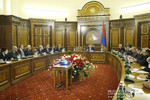
Chaired by Prime Minister Karen Karapetyan, a consultation was held in the Office of Government to review work on the development of a basic geo-information system (GIS) in Armenia. The system is being introduced in line with the Prime Minister’s instruction.
The State Committee of Real Estate Cadastre (SCREC) was said to have set up a geo-portal with connectivity channels provided to beneficiaries. A common platform has been created that allows communication operators and other organizations to see infrastructure in the same environment. Through the system, users can get information on the availability of gas pipelines, power lines, communication nodes and other engineering structures. At this point, the geo-portal offers data on linear infrastructure in Yerevan, Gyumri and Vanadzor. Work is to be continued to expand its geographical coverage. Efforts are underway to obtain the necessary information from infrastructure operators and make it available to beneficiaries.
Karen Karapetyan made a point of providing the required information to all stakeholders. “We need to ensure that information on the availability of utilities and other infrastructures be just a click away for geo-portal visitors. No matter the scheme to be used; what matters most is that the information so provided should be accurate and updated on a regular basis,” the Prime Minister emphasized.
The Premier instructed to complete the ongoing activities in cooperation with infrastructure operators, and make the necessary information available to geo-portal users within the shortest possible time.


