Saturday, 27 January 2018
PM: “Farmland registration will be one of the most important tasks of the Cadastre system in 2018”
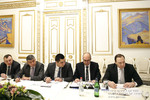
Chaired by Prime Minister Karen Karapetyan, a consultation was held today in the Office of Government to discuss the activities and priorities implemented by the State Committee on Immovable Property Cadastre by the Government in 2017, as well as the tasks set for 2018.
Karen Karapetyan highlighted the need for making more comfortable the services provided to citizens and businesses in 2018. “Farmland registration is one of the most important tasks because we have to solve the problem of unused land. At this point, the Ministry of Agriculture is thinking of how to activate those owners of agricultural land who do not use it. We also need to consider the issue of activating non-performing assets. In this respect, it is extremely important for us to take stock of property.”
State Cadastre Committee Chairman Martin Sargsyan noted that they are already working with the Ministry of Agriculture on the issue raised by the Prime Minister, and implementation mechanisms are now being discussed. The Prime Minister emphasized that digitized maps of agricultural land zones and property need to be developed.
Reporting on the planned activities carried out in 2017, Martin Sargsyan presented the reforms and their results, the achievements recorded in the system and the possibilities for coping with the existing problems. It was mentioned that over the past year, five local divisions have been merged with the territorial units in Yerevan and Marzes, 3 service offices have been merged with other offices, and 3 others have been liquidated. Another three service offices have been disbanded. Two SNCOs have been merged.
An amount of 378 million drams has been saved up as a result of optimization. AMD 800 million was contributed to the budget in State duties. Some services have been delegated to private operators entrusted with the functions of public authorities, and there was no problem identified with the services provided to citizens.
It was also reported that in 2017, the number of applications submitted to the territorial subdivisions of the cadastre system increased by over 20%, making 402 thousand applications in total. 11 thousand electronic applications were received by the Committee Staff, which is an increase of 15%. Citizens can now apply and receive the required documents online through the electronic document processing system.
It was reported that during the past year the number of real estate alienation transactions amounted to 52 274, which is 11.8% more than in 2016, while the number of real estate lease transactions increased by 22.4% in the reporting period. The Committee Chairman emphasized that the real estate market in the country will be assessed in accordance with territorial standards in 2018. To this end, the zoning activities have already been completed.
Referring to the ongoing reforms, Martin Sargsyan presented the steps to take with a view to forming a complete and accurate database of real estate, expanding the scope and improving the quality of online services. Martin Sargsyan reported on the process of mapping the geo-information system of Yerevan, Gyumri and Vanadzor, as well as that of creating the Committee’s geo-portal - a digital online working platform - which shall contain geographic data and appropriate analytical and search tools. The platform includes RA State governance bodies and the operators of linear infrastructure.
It was reported that in order to further improve the quality of services, the possibility of setting up necessary facilities for the functions of cadastral offices in Armenia’s consular offices are being discussed, which will greatly facilitate the implementation of transactions and the receipt of services by our compatriots abroad. An appropriate pilot program has already been implemented in the Artsakh Republic and St. Petersburg.
Prioritizing the implementation of the proposed programs, Karen Karapetyan singled out the registration of agricultural land and property, the updating of statistical data and the digitization of the system of cadastre.


